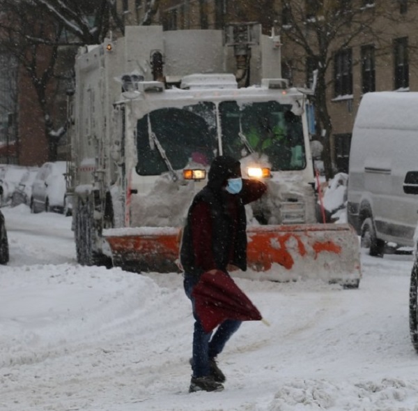
New York,(Asian independent) More than 15 million people across the US Northeast, Appalachians and southern Florida are under wind chill alerts as arctic air filters south and east behind the departing Nor’easter, which delivered a mix of heavy snow and gale along much of the East Coast over the weekend.
Morning low temperatures are forecast to be in the single digits and teens across much of the Northeast and Appalachians, reports Xinhua news agency.
However, some interior portions of New York and New England could see morning temperatures drop below zero. Winds behind the Nor’easter could gust as high as 40 mph in some locations in the morning.
“These strong winds combined with the cold air temperatures will cause wind chills to be as cold as 10 to 20 degrees (Fahrenheit) below zero,” reported CNN.
“This cold, arctic air will also impact locations as far south as Florida this morning, where several cities could see record morning low temperatures today.”
Morning low temperatures across the region will be in the upper 20s to mid-30s degrees Fahrenheit, but wind chills could feel as cold as 20 degrees Fahrenheit.
This is some of the coldest air to impact southern Florida in over a decade, leading the National Weather Service (NWS) office in Miami to warn of “falling iguanas”.
On Saturday, packing raking winds, blinding snows and piercing cold, a powerful, fast-moving winter storm roared up the East Coast, bringing power outages, disrupted travel and general misery to millions of residents.
“The worst of the storm was felt across the Northeast,” said The New York Times.
Power outages affected nearly 62,000 Massachusetts residents, and broader blackouts remained an ongoing concern with high winds threatening to snap snow-covered branches and cripple power lines as the storm churned offshore, according to the report.
Some areas in the state had received three to four inches of snow per hour Saturday morning. Heavy snow continued through the afternoon, with wind gusts of more than 70 miles per hour.
In the week ahead, Winter Storm Landon could bring a mess of snow, sleet and ice from the Plains to the Midwest and Great Lakes while soaking parts of the Northeast just days after Winter Storm Kenan’s heavy snow on Saturday, The Weather Channel reported on Sunday.
A fresh supply of arctic air will move into the nation’s midsection as a sharp, southward plunge of the jet stream carves into the western and central regions, pulling increasing moisture northward over the cold air, according to the report.


